Send Message
products

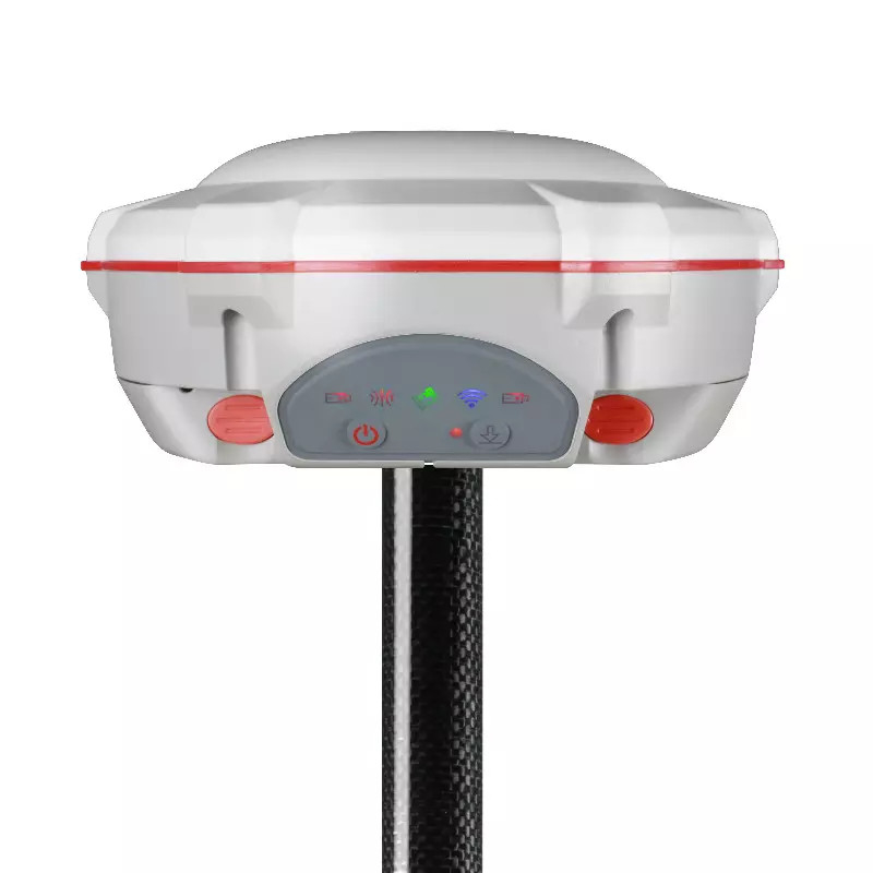
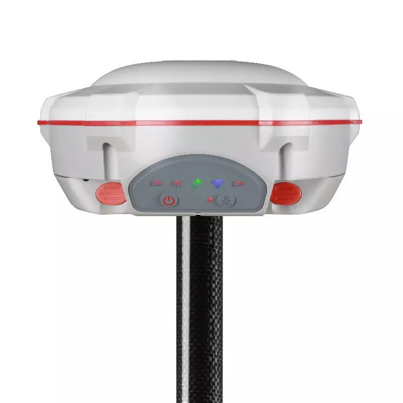
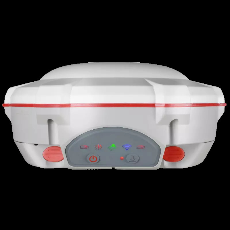
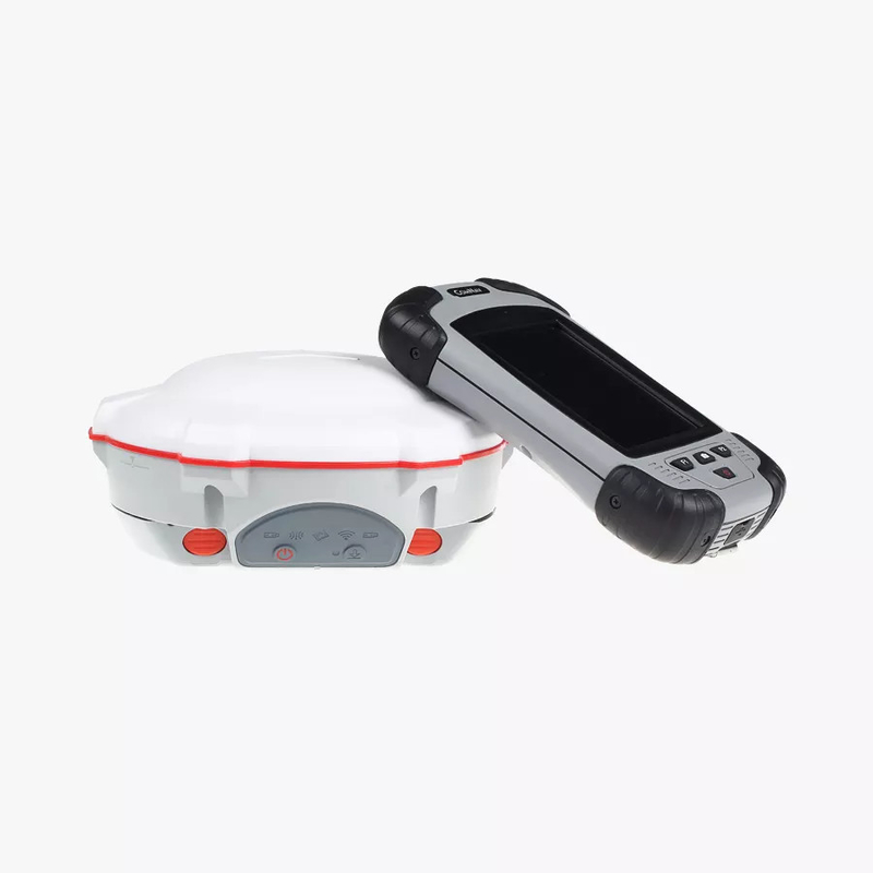
Sino / Comnav T30 For Land Cheapest GNSS Receiver Survey Equipment RTK

Basic Information
Place of Origin: China
Brand Name: Comnav
Certification: CE
Model Number: T30
Minimum Order Quantity: 1PC
Price: Negotiable
Packaging Details: With Standard Epxort Packing Ways
Delivery Time: 5-8 work days
Payment Terms: T/T, Western Union
Supply Ability: 1000pcs per year
Detail Information
High Light:

Land Survey GNSS Receiver

,

T30 Dual Frequency GPS Receiver

,

MU Sensor RTK GNSS Receiver


Product Description

Product Description


Product Description

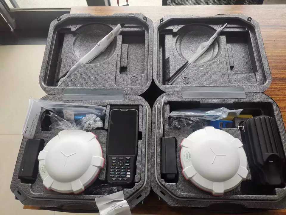
The Sino T30 GNSS receiver integrates professional LMU-RTK technology to provide a robust andaccurate positioning. in any circumstances. It combines state-of-the-art GNSS RTK engine, acalibration-free high-end MU sensor and advanced GNSS tracking capabilities to dramaticallyincrease RTK availability and reliability.The 90 automatic pole-tilt compensation boosts survey and stakeout speed by up to 30%Construction and land surveying projects are achieved with high productivity and reliabilitypushing the boundaries of conventional GNSS RTK survey.

Sino/Comnav T30 for Land Cheapest GPS Survey Equipment Rtk

SPECIFICATIONS
GNSS Performance (1)
Channels 660 channels
Communication
  Integrated 4G modem
  LTE (FDD):B1,B2,B3,B4,B5,B7,B8,B20
Network modem DC-HSPA+/HSPA+/HSPA/UMTS:
  B1, B2, B5, B8
  EDGE/GPRS/GSM850/900/1800/1900
  MHz
GPS
Galileo
L1 C/A, L2C, L2P, L5
E1, E5a, E5b
GLONASS L1, L2
BeiDou B1, B2, B3
SBAS L1 Wi-Fi
Bluetooth ® v4.1
QZSS L1, L2, L5
GNSS Accuracies (2)
  Horizontal: 8 mm+ 1 ppm RMS
Real time Vertical: 15 mm+ 1 ppm RMS
kinematics (RTK) Initializationtime: < 10 s
  Initialization reliability: >99.9%
Post -processing kinematics (PPK) Horizontal: 2.5 mm+ 1 ppm RMS
Vertical: 5 mm+ 1 ppm RMS
Standard Internal Rx/Tx: 410 - 470 MHz Transmit Power: 0.5 W to 2 W
UHFradio Protocol: C H C,Transparent, TT450, 3AS
Link rate: 9600 bps to 19200 bps
Range: Typical 3 km to 5 km
Post - processing static Horizontal: 2.5 mm+ 0.5 ppm RMS
Vertical: 5 mm+ 0.5 ppm RMS
Code differential
Positioning rate
Horizontal: 0.25 m RMS
Up to 10 Hz
Autonomous Horizontal: 1.5 m RMS Vertical: 3 m RMS
Data storage 32 GB internal memory
Electrical
Cold start: < 45 s Time to first fix (3) Hot start: < 10 s
Signal re-acquisition: < 1 s
Power consumption 5 W (depending on user settings)
RTK tilt - compensated Additional horizontal pole-tilt uncertainty
typically less than 10 mm+ 0.7 mm/° tilt
Hardware
159 mmx 150 mmx 110 mm
Size (L x W x H)
Environment
Ingress protection
(6.3 in × 5.9 in × 4.3 in)
Operating: -40°C to +65°C (-40°F to +149°F)
Storage: -40°C to +85°C (-40°F to +185°F)
IP67 waterproof and dustproof, protected from temporary immersionto depth of 1 m
Weight 1.26 kg (2.77 lb)
Humidity 100% condensation
Shock Survive a 2-meter pole drop
Tilt sensor Calibration- free IMUfor pole- tilt compensation. Immune to magnetic disturbances.
E-Bubble leveling
Front panel 4 LEDindicates 1.46'' OLEDDisplay


Packaging & Shipping
Sino/Comnav T30 for Land Cheapest GPS Survey Equipment Rtk

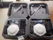
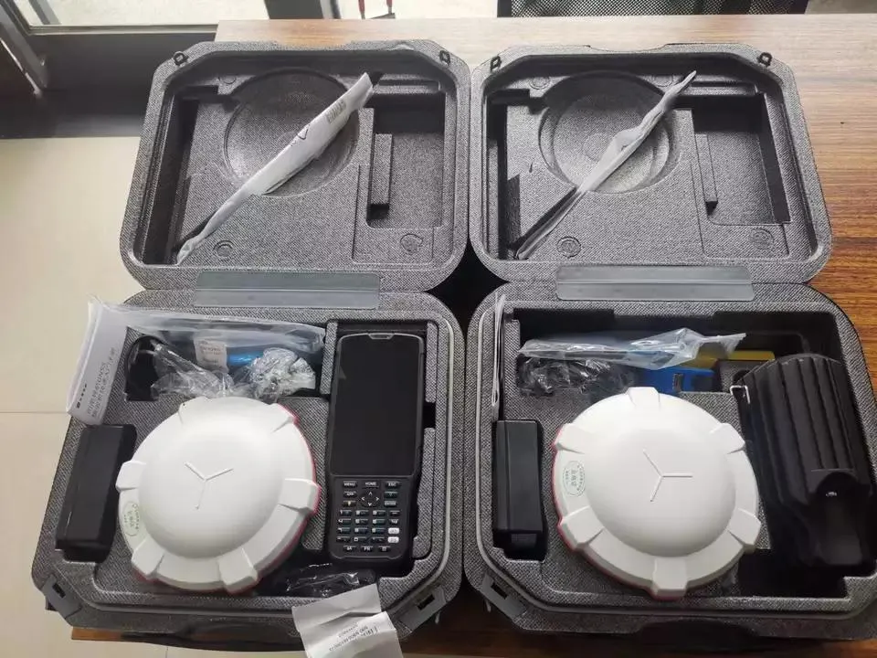
We can use the different international express company, usually, our first choice is DHL. if you have specified requirement , please inform us before the order.

Our Services
your inquiry will be replied within 24 hours, we welcome your email and call at any time.
our products are original and 100% new. and they will be carefully checked before we ship them out.
we provide one year quality warranty, within one year since you bought the products from us, you will get our technology support.
Company Information
Sino/Comnav T30 for Land Cheapest GPS Survey Equipment Rtk

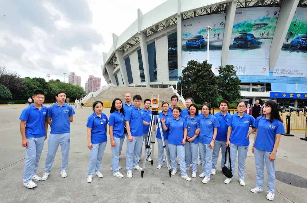
Shanghai Galxy International Trade company, Ltd. combining with developing, researching and producing. Our company is located in Pudong Developing Zone, and has two subsidiary companies: Shanghai Galaxy International Trade Co., Ltd. and Mato Opto-electrical High-tech Company. Our company has researching center and factory in Changzhou.

Our main products are as following: total station, electronic theodolite, automatic level, laser level, rotation laser, GPS, distance laser sensor and accessories, such as tripod, prism, pole, staff and USB cable for total station. Our company designs software for many domestic and oversea factories, for example, Boif, TJOP, Stanley, and Cst-Berger. We have powerful capacity in technical research, and the products we designed have advanced technology and steady performance. The non-prism total station and the absolute coding measure instrument we developed and produced have very competitive points in the measure instrument market.

We expect that we could cooperate with more business partners from all over the world. In addition, we can do OEM service for companies or dealers that want to find better producers in China.

Our goal is to produce the best surveying instruments in the world.

Our target is to globalize the market, internationalize the quality and maximize the profit!

Contact Us
TELL:+86-173 2126 1251
Contact person:Eva Hu
Shanghai Galaxy International Trade CO.,Ltd
ADD: Rm.306-308,No.5 Building,Jinglian Road 439#,Minhang District,Shanghai,China

Contact Details
Eva Hu

Phone Number : +8617321261251

WhatsApp : +8618301928717