Product Description:
Physical & Performance
Physical dimensions: 2.6" x 6.0" x 1.2" (6.6 x 152.2 x 3.0 cm)
Display size, WxH: 1.4" x 2.1" (3.6 x 5.4 cm); 2.6" diag (6.6 cm)
Display resolution, WxH: 128 x 160 pixels
Display type: 4 level gray LCD
Weight: 7.2 oz (203.1 g) with AA batteries
Battery: 2 AA batteries (not included)
Battery life: +18 hours
Water rating: IPX7
High-sensitivity receiver: Yes
Interface: Serial and USB
Features:
Maps & Memory
Waypoints/favorites/locations: 1,000
Routes: 50
Track log: 10,000 points, 100 tracks
Features:
- Floats: Yes
- Hunt/fish calendar: Yes
- Sun and moon information: Yes
- Area calculations: Yes
Technical Parameters:
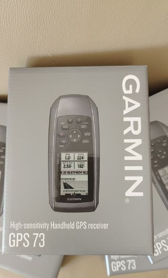
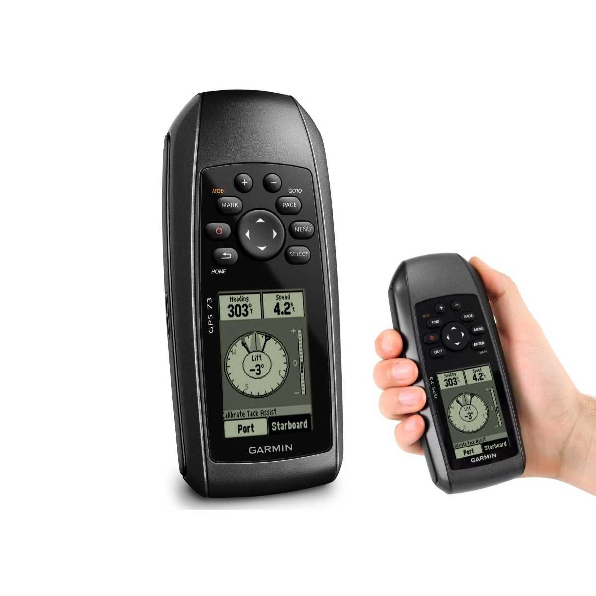
Easy-to-use GPS Handheld Navigator
High-sensitivity GPS marks and stores 1,000 waypoints and 100 tracks. Marks your favorite locations to easily navigate back to them. Garmin SailAssist™ for GPS 73 includes virtual starting line, heading line, countdown timers and tack assist. Sunrise/sunset, estimated time of arrival, other calculations and marine data. Built-in backlight.
This easy-to-use handheld is the perfect navigational solution for boats, sailboats or small watercraft that do not have a chartplotter. It’s also ideal as an important emergency navigation backup for all vessels. Its high-sensitivity GPS marks and stores 1,000 waypoints and 100 tracks so you can navigate right back to them. Use on land or water — it floats! Features SailAssist, including virtual starting line, heading line, countdown timers and tack assist.
Quickly Acquires Satellites
High-sensitivity GPS receiver quickly locks onto GPS signals and tracks your location even in challenging locations, such as deep canyons or under heavy tree cover.
Mark Important Waypoints
Whether it’s a hot fishing spot or a lobster pot, you can mark and store 1,000 waypoints and 100 tracks to navigate to and from time and time again.
SailAssist
SailAssist helps you sail more effectively with heading line and tack assist. Tack assist lets you know when to tack based on whether your boat is getting headed or lifted compared to the boat's optimal tacking angle. For those who like to race, there’s virtual starting line and countdown timer to make sure you cross the starting line at the right time.
Store Important Data
GPS 73 is NMEA 0183 compatible. To transfer data to your device, it easily connects to your computer via USB. If you're into boating, hunting or fishing, you can use the built-in celestial data, which includes sunrise/sunset times and a hunting and fishing calendar, estimated time of arrival, other calculations and marine data.
High-contrast Display
GPS 73 has an intuitive user interface with dedicated back-lit buttons for quick and easy operation. Its high-contrast display makes it easy to read in all lighting conditions.
Applications:
Product Application Occasions and Scenarios for the Garmin RTK GPS System:
The Garmin GPS73 RTK GPS system is a versatile and reliable device suitable for a wide range of applications due to its advanced features and robust design.
1. Outdoor Adventures: The Garmin GPS73 is perfect for outdoor enthusiasts engaging in activities such as hiking, camping, geocaching, and fishing. Its high-contrast display ensures excellent visibility even in bright sunlight, making it ideal for navigating through various terrains.
2. Marine Navigation: With its IPX7 water rating, the Garmin GPS73 is well-suited for marine environments. Boaters and sailors can rely on its accurate positioning data and navigation capabilities to safely navigate waterways.
3. Geospatial Surveys: Professionals in the surveying and mapping industry can benefit from the precision of the Garmin GPS73 RTK system. Its ability to store up to 10,000 points and 100 tracks allows for detailed data collection and analysis.
4. Field Work: Field researchers, archaeologists, and environmental scientists can efficiently conduct fieldwork using the Garmin GPS73. Its lightweight design, weighing only 7.2 oz with AA batteries, ensures portability without compromising on performance.
5. Emergency Response: During search and rescue operations or emergency situations, the Garmin GPS73 can provide accurate location information to responders, helping them navigate challenging environments and locate individuals in need of assistance.
Overall, the Garmin GPS73 RTK GPS system, originating from the US, offers a high-contrast display, making it a reliable and versatile tool for various outdoor, marine, professional, and emergency applications.
Customization:
Product Customization Services for the RTK GPS System
Brand Name: Garmin
Model Number: GPS73
Place of Origin: US
Dimension: 2.6" X 6.0" X 1.2" (6.6 X 15.2 X 3.0 Cm)
Display Resolution: 128 X 160 Pixels
Water rating: IPX7
Display Type: 4 Level Gray LCD
Weight: 7.2 Oz (203.1 G) With AA Batteries
Features: Quickly Acquires Satellites handle GPS, High-contrast Display, GPS 73
Support and Services:
The RTK GPS System product offers comprehensive Product Technical Support and Services to ensure smooth operation and customer satisfaction. Our technical support team is available to assist with any inquiries, troubleshooting, or technical issues that may arise with the product.
Our services include software updates, hardware maintenance, on-site support, and training sessions to help users maximize the capabilities of the RTK GPS System. We are committed to providing reliable support and services to meet the needs of our customers and ensure the product operates at its peak performance levels.

 Your message must be between 20-3,000 characters!