Product Description:
Physical & Performance
Physical dimensions: 2.6" x 6.0" x 1.2" (6.6 x 152.2 x 3.0 cm)
Display size, WxH: 1.4" x 2.1" (3.6 x 5.4 cm); 2.6" diag (6.6 cm)
Display resolution, WxH: 128 x 160 pixels
Display type: 4 level gray LCD
Weight: 7.2 oz (203.1 g) with AA batteries
Battery: 2 AA batteries (not included)
Battery life: +18 hours
Water rating: IPX7
High-sensitivity receiver: Yes
Interface: Serial and USB
Features:
Maps & Memory
Waypoints/favorites/locations: 1,000
Routes: 50
Track log: 10,000 points, 100 tracks
Features:
- Floats: Yes
- Hunt/fish calendar: Yes
- Sun and moon information: Yes
- Area calculations: Yes
Technical Parameters:
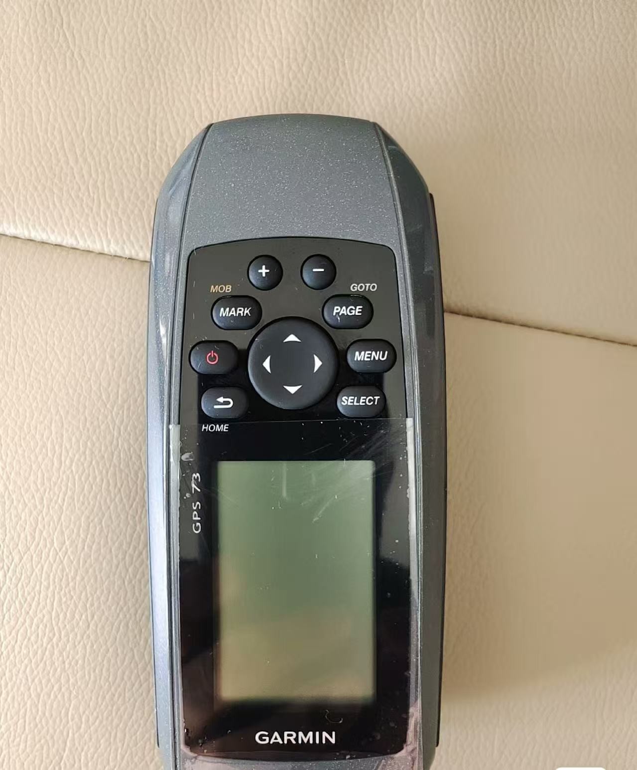
Easy-to-use GPS Handheld Navigator
High-sensitivity GPS marks and stores 1,000 waypoints and 100 tracks
Marks your favorite locations to easily navigate back to them
Garmin SailAssist™ for GPS 73 includes virtual starting line, heading line, countdown timers and tack assist
Sunrise/sunset, estimated time of arrival, other calculations and marine data
Built-in backlight
This easy-to-use handheld is the perfect navigational solution for boats, sailboats or small watercraft that do not have a chartplotter. It’s also ideal as an important emergency navigation backup for all vessels. Its high-sensitivity GPS marks and stores 1,000 waypoints and 100 tracks so you can navigate right back to them. Use on land or water — it floats! Features SailAssist, including virtual starting line, heading line, countdown timers and tack assist.
Quickly Acquires Satellites
High-sensitivity GPS receiver quickly locks onto GPS signals and tracks your location even in challenging locations, such as deep canyons or under heavy tree cover.
Mark Important Waypoints
Whether it’s a hot fishing spot or a lobster pot, you can mark and store 1,000 waypoints and 100 tracks to navigate to and from time and time again.
SailAssist
SailAssist helps you sail more effectively with heading line and tack assist. Tack assist lets you know when to tack based on whether your boat is getting headed or lifted compared to the boat's optimal tacking angle. For those who like to race, there’s virtual starting line and countdown timer to make sure you cross the starting line at the right time.
Store Important Data
GPS 73 is NMEA 0183 compatible. To transfer data to your device, it easily connects to your computer via USB. If you're into boating, hunting or fishing, you can use the built-in celestial data, which includes sunrise/sunset times and a hunting and fishing calendar, estimated time of arrival, other calculations and marine data.
High-contrast Display
GPS 73 has an intuitive user interface with dedicated back-lit buttons for quick and easy operation. Its high-contrast display makes it easy to read in all lighting conditions.
Applications:
The Garmin GPS73 RTK GPS System is a versatile and reliable handheld GPS device that is suitable for a wide range of applications and scenarios. Its lightweight design, weighing only 7.2 oz with AA batteries, makes it perfect for users who are constantly on the move and need a portable navigation solution.
One of the key features of the Garmin GPS73 is its ability to quickly acquire satellites, ensuring fast and accurate GPS positioning. This makes it ideal for outdoor enthusiasts, hikers, and geocachers who require precise location information in remote or challenging environments.
The 4-level gray LCD display of the GPS73 provides clear and easy-to-read navigation information, with a resolution of 128 x 160 pixels. This display ensures that users can easily view maps, routes, and waypoints in various lighting conditions, making it suitable for both daytime and nighttime use.
With a battery life of over 18 hours, the Garmin GPS73 is capable of handling long outdoor adventures without the need for frequent recharging. This extended battery life makes it a reliable companion for activities such as hiking, camping, fishing, and hunting.
The GPS73 also offers the ability to store up to 50 navigation routes, allowing users to plan and track their journeys with ease. Whether you are exploring new hiking trails, navigating waterways, or conducting field surveys, the GPS73 provides the necessary tools to help you reach your destination safely and efficiently.
Whether you are a seasoned outdoor enthusiast or a professional field worker, the Garmin GPS73 RTK GPS System is a dependable and user-friendly handheld GPS device that can meet your navigation needs in a variety of situations and environments. Trust in the Garmin brand name and the proven performance of the GPS73 to guide you on your next adventure.
Customization:
Customize your Garmin GPS73 RTK GPS System to meet your specific needs with our Product Customization Services. Store important data with the ability to save up to 1,000 waypoints/favorites/locations. The device features a 1.4" x 2.1" (3.6 x 5.4 cm) display with a 4 level gray LCD for clear visibility. Weighing only 7.2 oz (203.1 g) with AA batteries, this GPS system is lightweight and portable.
Designed to quickly acquire satellites, the Garmin GPS73 is equipped to handle GPS navigation with ease. Its 2.6" diag (6.6 cm) display provides a detailed view of your location and route. Powered by 2 AA batteries (not included), this device ensures reliable performance during your outdoor adventures.
Originating from the US, the Garmin GPS73 RTK GPS System offers advanced features such as SailAssist to enhance your sailing experience. Customize your device for optimal performance and personalized use to suit your navigation requirements.
Support and Services:
The Product Technical Support and Services for the RTK GPS System include:
- Installation assistance
- Troubleshooting guidance
- Software updates
- Calibration services
- Repair and maintenance options

 Your message must be between 20-3,000 characters!