Product Description:
Physical & Performance
Physical dimensions: 2.6" x 6.0" x 1.2" (6.6 x 152.2 x 3.0 cm)
Display size, WxH: 1.4" x 2.1" (3.6 x 5.4 cm); 2.6" diag (6.6 cm)
Display resolution, WxH: 128 x 160 pixels
Display type: 4 level gray LCD
Weight: 7.2 oz (203.1 g) with AA batteries
Battery: 2 AA batteries (not included)
Battery life: +18 hours
Water rating: IPX7
High-sensitivity receiver: Yes
Interface: Serial and USB
Features:
Maps & Memory
When it comes to navigation, the device supports a total of 1,000 waypoints/favorites/locations. Additionally, users can create up to 50 different routes to keep track of their journeys. For those who want to delve further into their outdoor adventures, the track log feature allows for a whopping 10,000 points across 100 tracks.
Features:
- Floats: Yes
- Hunt/fish calendar: Yes
- Sun and moon information: Yes
- Area calculations: Yes
Technical Parameters:
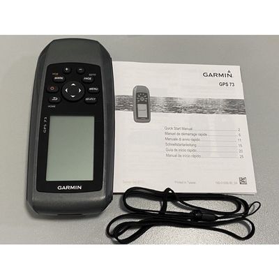
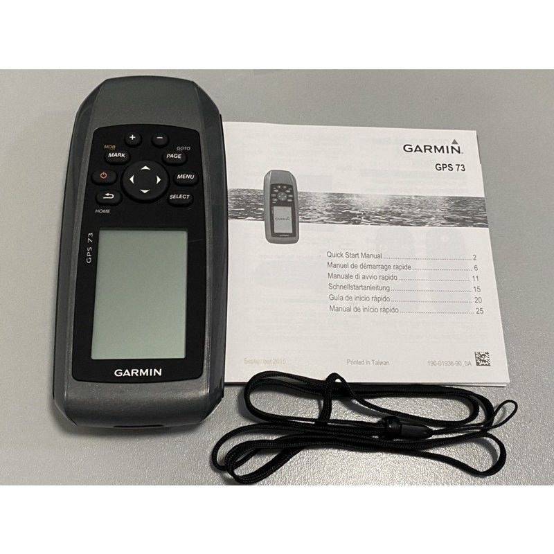
Easy-to-use GPS Handheld Navigator
High-sensitivity GPS marks and stores 1,000 waypoints and 100 tracks
Marks your favorite locations to easily navigate back to them
Garmin SailAssist™ for GPS 73 includes virtual starting line, heading line, countdown timers and tack assist
Sunrise/sunset, estimated time of arrival, other calculations and marine data
Built-in backlight
This easy-to-use handheld is the perfect navigational solution for boats, sailboats or small watercraft that do not have a chartplotter. It’s also ideal as an important emergency navigation backup for all vessels. Its high-sensitivity GPS marks and stores 1,000 waypoints and 100 tracks so you can navigate right back to them. Use on land or water — it floats! Features SailAssist, including virtual starting line, heading line, countdown timers and tack assist.
Quickly Acquires Satellites
High-sensitivity GPS receiver quickly locks onto GPS signals and tracks your location even in challenging locations, such as deep canyons or under heavy tree cover.
Mark Important Waypoints
Whether it’s a hot fishing spot or a lobster pot, you can mark and store 1,000 waypoints and 100 tracks to navigate to and from time and time again.
SailAssist
SailAssist helps you sail more effectively with heading line and tack assist. Tack assist lets you know when to tack based on whether your boat is getting headed or lifted compared to the boat's optimal tacking angle. For those who like to race, there’s virtual starting line and countdown timer to make sure you cross the starting line at the right time.
Store Important Data
GPS 73 is NMEA 0183 compatible. To transfer data to your device, it easily connects to your computer via USB. If you're into boating, hunting, or fishing, you can use the built-in celestial data, which includes sunrise/sunset times and a hunting and fishing calendar, estimated time of arrival, other calculations, and marine data.
High-contrast Display
GPS 73 has an intuitive user interface with dedicated back-lit buttons for quick and easy operation. Its high-contrast display makes it easy to read in all lighting conditions.
Applications:
Garmin's GPS73 is an easy-to-use GPS handheld navigator designed to provide accurate positioning data in various scenarios. Its compact dimensions of 2.6" X 6.0" X 1.2" make it portable and convenient to carry around, while its lightweight design of 7.2 oz ensures easy handling during outdoor activities.
With a battery life of over 18 hours, the GPS73 is suitable for long outdoor excursions where continuous GPS tracking is required. Its water rating of IPX7 means it can withstand immersion in water up to 1 meter deep for 30 minutes, making it ideal for marine environments and rainy weather conditions.
The GPS73 offers the capability to store up to 1,000 waypoints, favorites, or locations, allowing users to keep track of important data such as key landmarks, meeting points, or points of interest. This feature is particularly useful for hikers, campers, and outdoor enthusiasts who need to navigate through unfamiliar terrain or mark specific locations for future reference.
Whether you are hiking in the wilderness, sailing on a boat, or exploring remote locations, the Garmin GPS73 can assist you in accurately determining your position and navigating to your desired destination. Its reliable performance and user-friendly interface make it a valuable tool for outdoor enthusiasts, surveyors, geologists, and other professionals who rely on precise location data in their work.
With its origins in the US, the Garmin GPS73 combines American innovation and quality craftsmanship to deliver a durable and dependable GPS solution for a wide range of applications. Its intuitive features and robust construction make it a trusted companion for outdoor adventures, fieldwork, geocaching, and other activities where reliable navigation is essential.
Customization:
Enhance your RTK GPS System with our Product Customization Services tailored for the Garmin GPS73. Our services allow you to customize your device to meet your specific needs and preferences.
Key Features:
- Quickly Acquires Satellites handle GPS
- High-contrast Display
- Store Important Data
Product Attributes:
- Brand Name: Garmin
- Model Number: GPS73
- Place of Origin: US
- Weight: 7.2 Oz (203.1 G) With AA Batteries
- Navigation Routes: 50
- Display Type: 4 Level Gray LCD
- Water rating: IPX7
- Battery life: +18 Hours
Support and Services:
The RTK GPS System product comes with comprehensive technical support and services to assist users with any issues or questions they may have. Our team of experts is available to provide guidance on setup, troubleshooting, and usage of the RTK GPS System to ensure optimal performance.
Our technical support services include remote assistance, software updates, and troubleshooting guides to help users resolve any issues quickly and efficiently. In addition, we offer training sessions and webinars to help users maximize their use of the RTK GPS System and stay up to date on the latest features and capabilities.
Our goal is to ensure that all users have a positive experience with the RTK GPS System and are able to leverage its full potential for their projects and applications. We are committed to providing timely and effective support to address any technical challenges and help users make the most of their investment in our product.

 Your message must be between 20-3,000 characters!