Product Description:
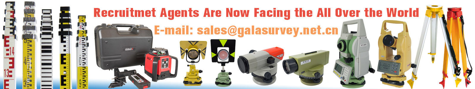
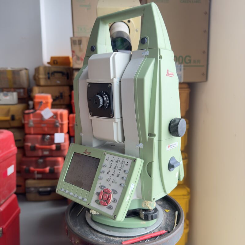
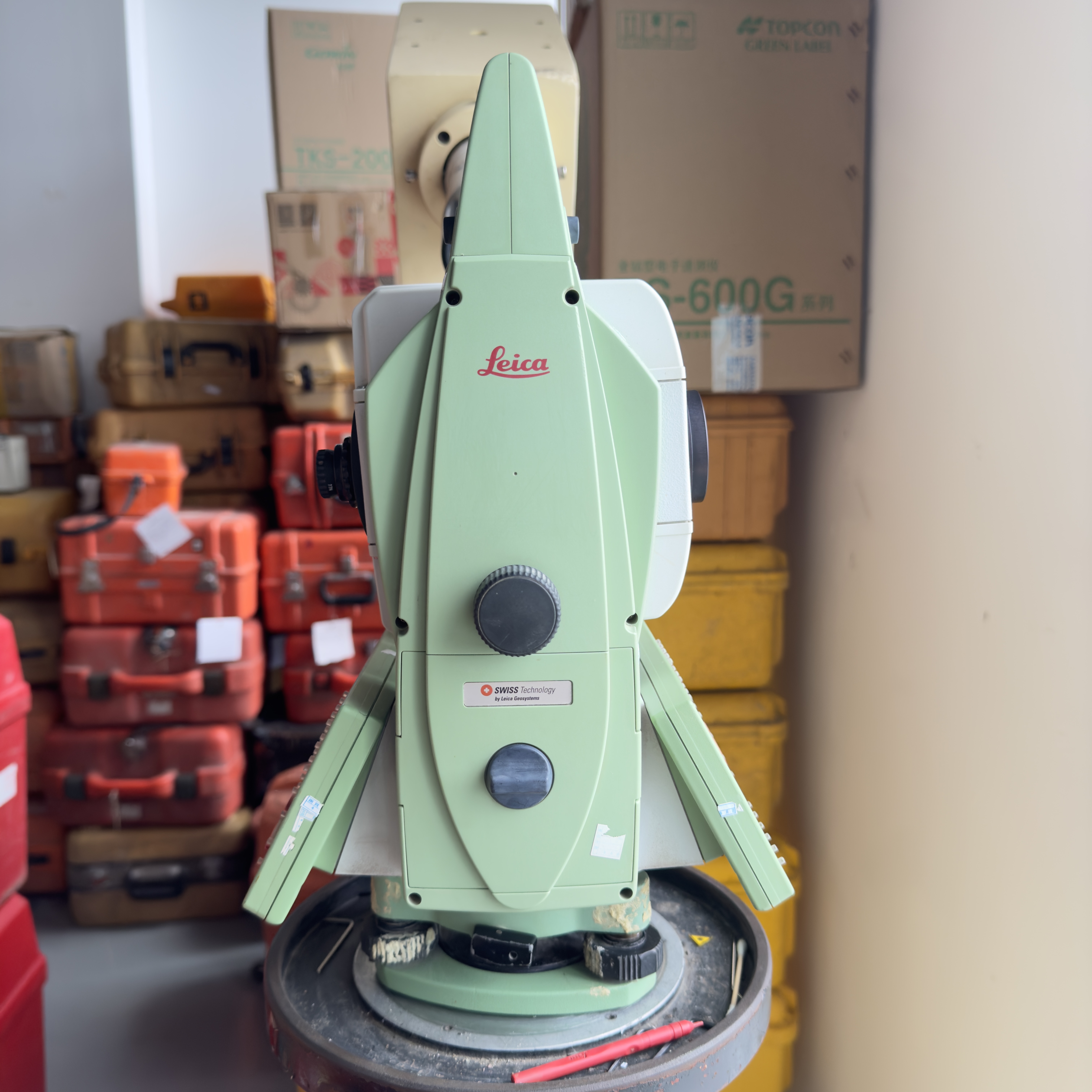
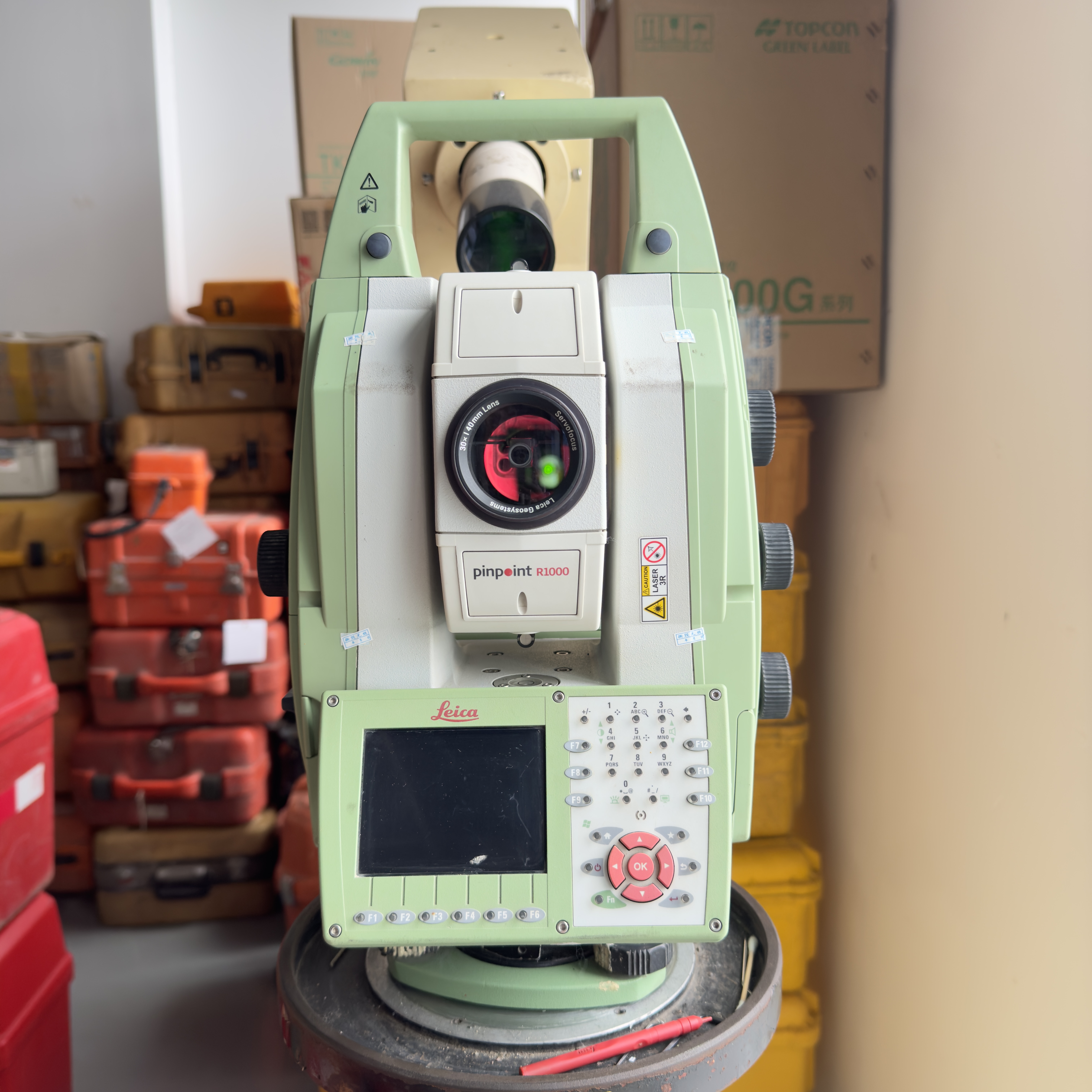
The Leica total station is a state-of-the-art surveying instrument designed to deliver unparalleled precision and reliability in various measurement tasks. Renowned for its advanced technology and robust build, the Leica total station is a preferred choice among professionals in construction, engineering, and land surveying. This product combines innovative features with user-friendly operation, ensuring that users can achieve accurate results efficiently and effectively.
At the heart of the Leica total station is its Real-time Operating System (RTOS), which provides seamless and rapid processing capabilities. The RTOS ensures that measurements are conducted with minimal latency, enabling real-time data acquisition and instant feedback. This operating system enhances the overall performance of the device, allowing surveyors to work faster without compromising on accuracy. The efficient data handling and processing power make the Leica total station suitable for complex surveying projects where time and precision are critical.
One of the key measurement methods incorporated in the Leica total station includes Absolute, Continuous, and Diametrical techniques. The Absolute method allows for direct measurement of coordinates relative to a fixed reference point, which is essential for establishing control points and mapping. Continuous measurement provides real-time tracking of moving targets, making it ideal for monitoring structural movements or dynamic construction processes. The Diametrical method is particularly useful for measuring diameters and circular features with high precision. These versatile measurement methods empower users to tackle a wide range of surveying challenges with confidence.
The Leica total station features a coarse accuracy of 0.6 seconds, with an initial precision of 1.3 seconds, which underscores its exceptional angular measurement capabilities. This level of accuracy ensures that every angle and distance reading is reliable, enabling professionals to produce detailed and accurate site plans, topographic maps, and construction layouts. The precision engineering behind the Leica total station guarantees consistent performance even in demanding field conditions.
Durability and resilience are paramount in field instruments, and the Leica total station excels in this regard with its IP66-rated dust and water resistance. This robust protection allows the device to withstand harsh environmental conditions such as dust storms, heavy rain, and extreme weather, ensuring uninterrupted operation in outdoor settings. The IP66 rating signifies complete protection against dust ingress and powerful water jets, making the Leica total station a dependable tool for daily use in rugged terrains and challenging environments.
In addition to its surveying capabilities, the Leica total station also functions as a digital level, providing precise elevation measurements that are crucial for construction and civil engineering projects. The integration of digital leveling technology simplifies the process of determining height differences and gradients, enhancing the overall utility of the instrument. This dual functionality makes the Leica total station a versatile and cost-effective solution for professionals seeking to optimize their workflow.
Overall, the Leica total station represents a perfect blend of advanced technology, precision, and durability. Its sophisticated Real-time Operating System, multiple measurement methods, fine angular accuracy, and robust IP66-rated design make it an invaluable asset for surveyors and engineers worldwide. Whether you are conducting topographic surveys, construction staking, or infrastructure monitoring, the Leica total station offers unmatched performance and reliability. Embrace the future of surveying with the Leica total station, a trusted partner in achieving precise and efficient measurement results every time.
Features:
- High precision Leica total station with minimum readout options of 1", 5", and 10"
- Dust and water resistance with an IP66 rating, ensuring durability in tough environments
- Fast coarse measurement speed of 0.6 seconds (initial measurement 1.3 seconds)
- Large memory capacity featuring 1G mass data storage for extensive data handling
- Reliable and accurate total station designed for professional surveying and construction tasks
Technical Parameters:
| Size |
5.0″ Capacitive Multi-Touch |
| Hs Code |
9015800090 |
| Memory Type |
Internal Flash Memory And External SD Card |
| Trademark |
Leica |
| USB Port |
With USB Port |
| Memory |
Memory 1G Mass Data Storage |
| Auto Leveling |
Automatic Compensator With ±3 Arc Minutes Range |
| Data Format |
ASCII |
| Method |
Absolute, Continuous, Diametrical |
| None Prism Distance |
1000m |
Applications:
The Leica TM50 Total Station, originating from Switzerland, is a cutting-edge surveying instrument designed to meet the highest standards of precision and reliability. Certified with CE, this product is ideal for professionals requiring advanced measurement capabilities combined with robust functionality. With a minimum order quantity of just 1 PC and a competitive price of 12,800 USD, the Leica TM50 offers excellent value for surveyors, engineers, and construction professionals worldwide.
The Leica TM50 is extensively used in various application occasions and scenarios, making it a versatile tool in the field of geospatial measurement. It is perfect for land surveying, construction site layout, topographic mapping, and infrastructure development projects. The instrument’s ability to achieve none prism distance measurements up to 1000 meters enhances its utility in large-scale projects where long-range accuracy is essential. Compared to other brands like Trimble total station and Topcon total station, the Leica TM50 stands out with its superior memory capacity, featuring 1G of mass data storage combined with both internal flash memory and external SD card support, allowing for efficient data handling and transfer on-site.
In GPS RTK (Real-Time Kinematic) integrated workflows, the Leica TM50 total station excels by enabling seamless coordination and high-precision positioning. This makes it indispensable in scenarios where GPS RTK technology is used alongside total stations for enhanced accuracy in surveying tasks such as boundary determination, civil engineering, and urban planning. The instrument’s minimum readout options of 1", 5", and 10" provide users with flexible precision settings tailored to different project requirements.
The Leica TM50’s packaging includes a sturdy carton and plastic box, ensuring safe transport and delivery within 2-3 days, backed by a supply ability of 1000 units per month. Payment terms via TT add convenience for international buyers. Its compact yet durable design, combined with advanced features and comprehensive certification, makes the Leica TM50 total station an indispensable tool for professionals seeking reliable, high-precision surveying equipment in diverse environments and challenging conditions.
Support and Services:
Our Product Technical Support and Services for the Total Station are designed to ensure optimal performance and customer satisfaction. We provide comprehensive assistance including installation guidance, operation training, calibration services, software updates, and troubleshooting support. Our team of experts is dedicated to helping you maximize the accuracy and efficiency of your Total Station equipment. Whether you need on-site service or remote assistance, we are committed to delivering timely and professional support tailored to your specific needs.
Packing and Shipping:
Product Packaging and Shipping for Total Station
The Total Station is carefully packaged to ensure safe delivery and optimal protection during transportation. Each unit is securely placed in a custom-fitted foam insert within a sturdy, impact-resistant carrying case to prevent any damage from shocks or vibrations.
Inside the carrying case, the Total Station is accompanied by all necessary accessories, including the tripod mount, battery, charger, and user manual, each organized neatly to avoid movement during transit.
The carrying case is then placed inside a robust outer carton box with additional padding materials to provide extra cushioning. The packaging is sealed and labeled clearly with handling instructions such as "Fragile" and "This Side Up" to inform handlers of the product's delicate nature.
We offer multiple shipping options including standard ground shipping, expedited air freight, and international shipping, ensuring timely and reliable delivery to your location. Tracking information is provided upon shipment for your convenience and peace of mind.
Our packaging and shipping processes are designed to guarantee that your Total Station arrives in perfect working condition, ready for immediate use in your surveying and construction projects.

 Your message must be between 20-3,000 characters!